Mobile
 PC
PC
 Full-Cycle
 Co-Development
 Outstaffing
Overview
Happs is a dynamic geo-mapped data visualisation system that provides data which includes roads, buildings, trees, roofs and other elements belonging to an Urban area, which customizes the data according to the structured queries.
Game development
Built for your engine & platform. Scoped to your model.
Built for your engine & platform. Scoped to your model.
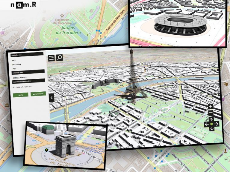


Happs is a dynamic geo-mapped data visualisation system that provides data which includes roads, buildings, trees, roofs and other elements belonging to an Urban area, which customizes the data according to the structured queries.

A SIMPLE AND ADDICTIVE GOLF GAME

HOW ABOUT A NICE GAME OF POOL?